Cemeteries & Locations - M – R
MARTIN CHURCH CEMETERY
141 Inscriptions
Located in the once thriving community of Goforth in northeast Hays County, the cemetery is relatively hidden from travelers driving down the nearby road to Niederwald. It is known to residents of that area and to descendants of early Goforth settlers. It is well fenced, kept clean, and is approximately one acre or more in size. Mr. Joe Martin provided three acres of land for a church and cemetery. There are at least fifteen to twenty unmarked graves and several that have only funeral home markers to mark the burial site. The cemetery is still being used; however, it is not often that anyone is interred there.
We found by checking our recording with an earlier recording made over twenty years ago that there are stones or funeral home markers missing since the first reading. Possibly those who recorded the first reading, which was published in the Hays County Historical and Genealogical Society's quarterly magazines, put down names of persons whom they knew to be buried in the cemetery even though there may not have been a stone or marker. One could look in these records for names if they do not appear in our listing. We recorded only the stones or markers which are presently in the cemetery. However, we want to mention that in the 1960 ' s there was a marker for Claude E. McMahan b . Oct. 7, 1883; d. Feb. 4, 1962, which no longer is in the cemetery. Possibly vandals are responsible for its disappearance, or it may have been a funeral home marker which has deteriorated. Also, we found in researching veterans records that George Clinton Richards (1837-1894) was a veteran of the CSA. His stone does not show this information.
We are grateful to Cassia Hodge for helping copy the inscriptions in the cemetery.
2008 Update: In June 2008, Cecil Clark, a vital 95-year old, remains in charge of caring for Martin Church Cemetery. The well-kept site, still occasionally used for burials, continues to be one of Hays County’s most beautifully-maintained small cemeteries. For information on burials and cemetery records, contact Mr. Clark at his home in Buda. He is also the official caretaker for Live Oak Cemetery at Manchaca, just north of Buda.
MARTIN FAMILY CEMETERY
3 Inscriptions
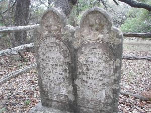
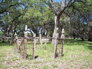
The Martin Family Cemetery is located in the northwest part of Hays County just off County Rd 188. It has almost been abandoned; however, it is well fenced and is visited on occasion by family descendants. The last recorded burial was in 1938. There are only three marked graves and one of those is marked with a funeral home marker, which is in very poor condition. There is one nice double headstone marking the graves of William Martin and his wife, Rutha. The cemetery is out in a pasture among cedar trees and is surrounded by private property.
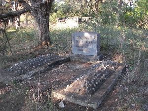
William Martin, age 36 (farmer) and his wife, Rutha A., age 30, were listed on the 1880 Hays County census along with five children. It stands to reason that some of their family are buried in this cemetery also. There are indications of several other graves and one or two are marked with a lot of seashells or small pebbles, indicative of a child's grave. There are several limestone rocks used to mark the heads of graves but no indication of who are buried in the graves.
We received a letter in 1991 from Mozelle Sorrell Joy of Dripping Springs stating that buried in this cemetery, in unmarked graves, are persons who lived in the area: Mr. Hackney, Mrs. Moore- who was a midwife, and two infants. One was infant of William and Lou Crissie Martin McCormick, and the other was infant of Ollie and Hattie Fairly Martin.
We are grateful to Mr. Breed, a rancher in the area, for accompanying us to the cemetery and for facing the vicious pit bull dog and chow with us. We recommend that you make arrangements with the landowners before visiting the cemetery or have a law officer accompany you.
To reach the cemetery, located approximately half way between Dripping Springs and Henly, take U.S. Hwy 290 west out of Dripping Springs to the junction of McGregor Lane (CR 187). Turn right onto McGregor Lane, and drive 1.7 miles to the junction of Martin Rd (CR 188). Turn left on Martin Rd, and drive 1.6 miles. Just after crossing a cattle guard in the road, there will be two metal gates on the right with a fence line separating the two pieces of property. The road leading from the first gate will lead you to the cemetery. It will be on the right side of this road, which leads up a hill for approximately 300 yards. The cemetery will be approximately 50 yards out in the pasture.
MASSEY CEMETERY
The Massey family’s burial ground is no longer to be found. The plot of ground is located on the Storm Ranch, which once belonged to the Martha Wanslow Massey family (Wanslow Survey). The Storm Ranch is located on RR 12, approximately 7 miles south of Dripping Springs, on the west side of the road.
When Peter M. Massey sold the land, he protected a quarter acre site for a graveyard for “graves already there (Carrie C. Turner, Martha Wanslow Massey, and probably others) with the additional privilege of burying P.M. Massey and his father therein if desired.” Records show that the quarter acre was to be “laid out to place the grave of Mrs. Martha Masseey in the exact NE corner.”
From prior readings it is known that Wiley L. Massey, Martha Wanslow Massey (d. February 6, 1903), Carrie C. Massey Turner, and Peter M. Massey are buried in this cemetery.
Editor’s note: At the time of the publication of Hays County Cemetery Inscriptions, Vol. I (revised 1994), authors Jo Ann Elam Hearn and Dorothy Kerbow thanked the late Lynn and Maxine Storm for information regarding this cemetery. They also expressed gratitude to the Hays County Historical and Genealogical Society for publishing the above recording in that group’s quarterly publication “many years ago.”
McGEHEE GRAVE
1 Inscription
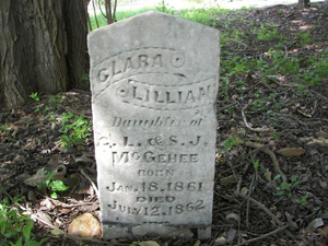
Located on private property, you must ask permission to enter to visit this gravesite. The grave of the daughter of Charles L. and Sarah Jane McGehee is located under a large oak tree in the front of the restored historic McGehee Cabin located on the Baugh Ranch (Rancho del Camino Real). The stone does not mark the exact burial site of the little girl as the stone was discovered out in a plowed field. The Baughs felt it should be placed near the cabin where it may have originally rested and where it could be cared for.
To reach the Baugh Ranch, drive 2.2 miles east (toward Luling) from the intersection of IH 35 and U.S. Hwy 80. Turn right onto Caldwell County Rd 101 (directly across from a historic marker marking the McGehee Crossing). Drive 1.4 miles, crossing a low water bridge, to the entrance of Rancho del Camino Real on the left side of the road. This road will have become Hays Co. Rd 266. ~Approximately one mile up the paved road into the ranch will be the restored.
McGehee Cabin. Directly in front of the cabin, across the road and under a large oak tree is the lone grave of the little girl. We are thankful to the Baughs for allowing us to enter and copy the stone.
McKELLAR CEMETERY
The McKellar cemetery was another one of those small family cemeteries that seemed to have disappeared. The cemetery is pinpointed on the State Highway Department's map but we were unable to locate it before we published our first printing. The map shows this cemetery to have been on Creek Road out of Dripping Springs, a short distance from the Middlebrook(s) Cemetery on the opposite side of the road (Hays Co Rd 190).
We mentioned in our first writing that a lady in the area said she had visited the site long ago d there were no tombstones. This proved to be true.
In early 1992 a Mr. Ehrlic contacted us and said he would take us to the cemetery, which he did. The cemetery was clean, newly fenced and burial sites were marked with rocks; however, there were no inscriptions on any of them. Descendants have told us that at one time graves were marked with wooden crosses. We discovered later that cattle had been allowed to roam the area over the years. Several fences had been erected in years past, which had fallen to disrepair.
It was early this year (194) that a letter was discovered in our archive papers stating that a Mrs. Henrietta Miles McKellar Sorrell, wife of Jacob Sorrell and mother of Maner Sorrell, was buried in this cemetery. After contacting Ms. Lorraine Joy of Henly we learned that Maner Sorrell passed away a couple of years ago and was I buried in Phillips Cemetery. His children had a new fence erected around the McKellar cemetery because it had meant so much to him- his mother having been buried there.
We have since received information from Ruth Berg, a McKellar descendant, on names of some burials in ~e cemetery. Two are children of Henrietta Miles McKellar and her husband Jacob Peter Sorrell. They are Mamie Bell Sorrell b. 12-19-1887 and died as an infant; James Lauchlin Sorrell, b. 1891 and died as an infant. Also buried in this cemetery are Estelle McKellar b. 1866 d. 1891, and Minnie May McKellar b. 6-~9-1871 d. 2-3-1873. Ruth believes that Lauchlin McKellar (1820-1882) and Annailes Maner McKellar (1832-1892) are also buried in this cemetery.
We found a reference to a. L. McKellar who was a trustee for Mt. Gaynor* School located between Mt. or and Henly and who was also the postmaster for Mt. Gaynor.
The Cemetery is located off Creek Road (Hays Co. Rd. 190) approximately 4 miles out of Dripping on the Widane Ranch. To reach the cemetery from Creek Road you must through private fields and locked gates approximately 1/4 mile. It sits atop a hill and is not visible from the road. The Sorrell family descendants are caring for the cemetery. The present ranch foreman is W. D. Weiershausen.
*Mt. Gaynor is spelled Mt. G-a-y-n-o-r on Washington D.C,'s list of early Post Offices and G-a-i-n-o-r on Texas Highway Department's official road maps of Hays County as well as Texas Land Office records. Gaynor is the correct spelling.
MIDDLEBROOKS CEMETERY
26 Inscriptions
You will notice from the inscriptions in this cemetery that some of the family dropped the "s" from the surname. The earliest burial recorded on a stone is that of Mary Jane Wade in 1875. In our research of cemetery records, we discovered that the Hays County Historical and Genealogy Society had published inscriptions from this cemetery and had recorded the death date of this same stone as 1815, with a notation that the grave must have been moved here as it was too early to have been originally buried in this cemetery. We "chalked" the stone which made the date stand out clearly and it was 1875, not 1815. By using this process we have been able to read clearly more dates from the older stones.
In research we found a record of Sam B. Harbour, born January 3, 1855; died February 15, 1936, at age 81, as having been buried in the Middlebrook Cemetery. His grave is marked as S.B. with only the year of death. Also, in research Seaborn Middlebrook is listed on the 1880 Hays County Census as a farmer, age 72, and born in Georgia. His stone reads "5.5."
The cemetery is located 4.7 miles west of Dripping Springs on the O.T. Doell Ranch. Take County Rd 190 west from Dripping Springs for 2.4 miles to the point in the road where the road forks.
Stay to the right on 190, and go 2.3 miles farther. There is a gate on the left side of the road with O.T. Doell's name on it. The cemetery is located inside the ranch, up the lane approximately a quarter of a mile. It is atop a rise in the road on the left side. You have to look carefully to see the roadway leading to it as it is not traveled frequently and the weeds were growing in the roadway.
We are grateful to Mr. Cecil Griffin of Henly who accompanied us to the cemetery and helped copy the inscriptions.
2008 Update – Middlebrooks Cemetery is a classic Hill Country burial ground, with a wide variety of tombstones and other native stonework. The gate at the road is locked today, but access was thankfully arranged through Oscar T. Doell of Austin. If anything has changed since the visits of Kerbow and Hearn, likely it is the continued weathering—and loss—of tombstone inscriptions from soft, flaking stone. A complete historical survey, facilitated by a cemetery cleaning, is in order for this historic site.
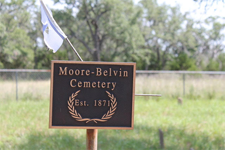
MOORE-BELVIN CEMETERY
8 Inscriptions
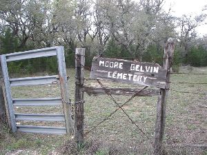
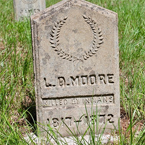
Located on the Blakely Ranch near Barton Creek out of Henly in the northwestern part of Hays County, there are eight inscriptions in this cemetery. There appears to be several small graves also in this cemetery but they are not identified. The cemetery has a nice fence enclosure and when we visited it, it had been mowed and was very clean and well cared for.
This cemetery holds the remains of L.D. Moore who was a commissioner for the county and who was murdered by the Indians. His stone makes notation of this incident. He was probably one of the last citizens in the area to be killed by Indians.
To reach the cemetery take U.S. Hwy 290 west from Dripping Springs toward Henly. Drive approximately five miles until you reach the junction of McGregor Lane (CR 187) Take McGregor Lane north and go 1.7 miles to the junction of Martin Rd (CR 188) Turn left onto Martin Rd and go .2 mile. The cemetery is on the right side of the road. You will need to drive slowly and look carefully. There is a sign on a gate on the fence line adjacent to Martin Rd, with the name "Moore -Belvin" on it. There is a pathway leading from this gate over to the cemetery which is approximately 50 yards from the roadway.
MOUNTAIN CITY OAKS GRAVE
1 Inscription
A lone grave situated along the street in front of a new home (1888) in the Mountain City Oaks Subdivision marks the burial site of Sarah Rector, wife of Dr. Benjamin Rector of Bastrop County. Sarah died after her husband and had planned to be buried beside him in Bastrop; however, at the time of her death it is reported that there was an ice or snowstorm, which prevented her body from being transported back to Bastrop. She either was living with or visiting her children in Mountain City at the time she took ill and died. It was decided to place her to rest under a mott of oak trees near the home of her children.
There have been several articles written in recent years regarding this grave, as it is located in an unusual place. When the land was subdivided, the developer wanted to remove the grave but the descendants would not agree to it. A burial site is protected by law and without permission a re-interment could not take place. It has worked out quite well, as past owners of the home took the time and trouble to restore her stone, and frequently placed flowers on her grave.
To locate this gravesite from the intersection of FM Rd 150 and FM 2770 at the Pedernales Electric Cooperative's office just out of Kyle, take 2770 northeast for 2.7 miles. This will take you to the second entrance of Mountain City Oaks. Turn left on Pin Oak Drive. The grave is located on the right side of the street in the front yard of the first home, presently owned by Jay and June Tilby. It is less than .1 mile from 2770 into the subdivision.
MT. SHARP CEMETERY
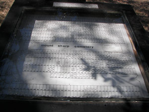
88 Inscriptions
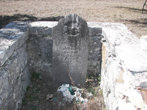
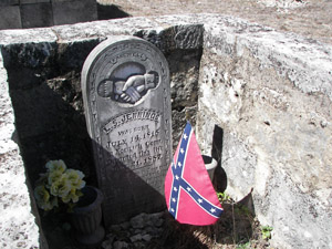
Mt. Sharp Cemetery was established when Mr. Alex Jennings (1852-1932) donated two acres of land to be equally divided for a school and a cemetery with the school portion being deeded to a trustee of the school, Robert Jennings. It was stipulated that if Robert Jennings moved from the school district or died, the land would go to another trustee. In the event that the school dissolved, the land would revert to Alex Jennings or his heirs. This indeed did happen and the land reverted to Alex who then deeded all of his property to his son, J.T. "Tom" Jennings, for taking care of him for the rest of his lifetime.
Had the family and others been aware of the law which prevents cemeteries or burial grounds from being sold or deeded to anyone, much money, worry, and hard feelings would have been prevented. This family cemetery has had its share of trouble in the recent past. It has finally been resolved and a cemetery association has recently been formed with rules and regulations regarding burials in the cemetery. Officers have been elected and presently a Mr. Dally from the Dripping Springs area is in charge of the cemetery.
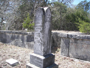
Prior to the family members organizing a cemetery association several members of the Calhoun family were re-interred in the cemetery, having been moved from the old Calhoun Cemetery in Comal County near the settlement of Sattler. This was done when the Calhoun Cemetery had to be moved when Canyon Dam was being built. It was to be covered with lake water. Most of the descendants of the families buried in Mt. Sharp did not know of this action until after it was done. Along with the bodies of the Calhoun family was the body of an itinerate preacher who had been buried in the Calhoun Cemetery when he had taken ill and died while in the Sattler area. Also buried in this cemetery are two other persons who are not connected with the Jennings family, a Mrs. Isabell and Rollie J. Sing. It is reported that they died while living in the area and had no place to be buried. Their families were allowed to bury them in the Mt. Sharp Cemetery.
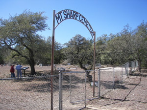
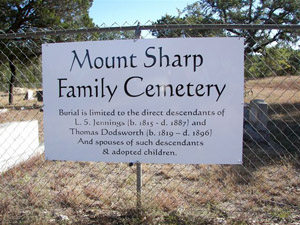
The cemetery has a new fence around it with its name over the entrance gate. It has been cleaned and is being taken care of in the manner in which a cemetery should be attended.
We are grateful to Mrs. Leona Calhoun of Blanco for furnishing us with the history of this cemetery.
To reach the cemetery from Wimberley, take PM Rd. 2325 at the Y and drive 11.5 miles toward Blanco to the junction of Co. Rd. 219. Turn right onto 219, and drive 1.7 miles to curve in road. Take left turn staying on 219. Go .7 mile farther. Cemetery is on right side of road. You will need to look carefully to see it as it sits back off the road approximately 50 yards. It does have its name over the gate, however. You will have to drive slowly because of the road conditions, and it is advisable to drive a four-wheel drive or pickup truck, especially if there has been a recent rain.
NICHOLS CEMETERY
1 Inscription
The Nichols Cemetery is an abandoned cemetery located on the Wilburn Ragsdale Farm on Hays County Road 265. It is located out in an open field, fenced, and under a mott of trees, mostly hackberry. There is only one tombstone visible and legible. There is evidence that many burials were made at this site. Possibly by raking the grounds, other stones could be uncovered. This little cemetery appears to be approximately 50' x 75' in size.
At one time the land on which this cemetery is located belonged to an Afro- American family by the name of Nichols. It was later sold to a Mr. Berry and has been sold several times since then. According to Mr. Frank James, who grew up in this area of the county, this particular strip of the county was settled by Afro-Americans who were either given land or purchased land after the Civil War. The Harris, James, Nichols, and Berry families were early settlers of this area. Mr. James related that there were members of the Grass family also buried in the cemetery.
From research, we know that Ollie or Allie Nichols, born February 29, 1908, died March 24, 1920, age twelve years and one month, son of Robert and Ida (Watson) Nichols, is also buried in this cemetery in an unmarked grave. We also found an account of a small black child, Mirtle Washington, age one year and four months, who died on November 12, 1910, as having been buried at York Creek. Probably it was a reference to this cemetery as it is nearer York Creek than any other cemetery serving the Afro-American citizens.
There is another cemetery nearby which holds the remains of Afro-Americans (Holmes) and it too has almost disappeared.
To reach the Nichols Cemetery take Posey Road Exit off IH 35, south out of San Marcos approximately five miles. Turn left and go under the IH 35 overpass. This will be Hays Co. Rd 235. Drive 1.3 miles to the intersection of Co. Rd 266 and 235. Turn right onto 266, and drive .8 mile to the junction of Co. Rd 265. Turn left onto 265, and follow the road for 1.3 miles to the point where large electric poles and lines cross the road. The road will curve to the right at this point. Look to your right and the cemetery will be out in the middle of a field approximately 300 yards, under a mott of trees. Permission must be obtained before crossing private property to visit the cemetery. Mr. Ragsdale has been very cooperative with us and with descendants of the family visiting the cemetery. We are grateful to him for taking the time to accompany us to this little cemetery.
NIEDERWALD CEMETERY
112 Inscriptions
The Niederwald Cemetery is located on the county line of Caldwell, Hays, and Travis counties. There has been, over the years, a dispute as to which county the cemetery lies within. It is not on anyone of the Texas Hwy Dept's maps for any of these three counties. You would need a surveyor's judgment to make the decision and because of this we have included it in the Hays County cemetery records. It may also be reported in the Caldwell county records. The town of Niederwald itself is divided into two counties with the old Camino Real running right through the middle of the town.
Niederwald Cemetery is rather small, covering approximately one acre of land. It is one of the most well kept cemeteries we have visited, not at all like the name implies. {Niederwald is a German word for underbrush.) The cemetery was named for the community from which it sprang. It is a relatively new cemetery with the first marked grave being that of Ernst Schaarschmidt, born July 24, 1896, and died January 21, 1905, followed by an infant of the Schaeffer family who was born and died in 1906.
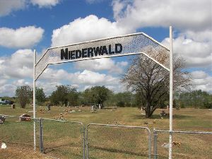
Niederwald is located in the northeast portion of Hays county on Hwy 21 {Bastrop Highway) approximately fifteen miles from San Marcos. From San Marcos take Hwy 80 east toward Luling. Pass over the Blanco River Bridge within the city limits of San Marcos and drive approximately .3 mile to the junction of Hwy 21. Turn left onto 21, and follow that road to Niederwald. You will pass through the community of Uhland before reaching Niederwald. When you reach Niederwald, stay on Hwy 21 all the way through the community and approximately one mile the other side adjacent to the highway on the left side of the road will be the Niederwald Cemetery. You cannot miss it. It has a double gate with the name atop it. There is also, right next to it, a historical marker, marking the El Camino Real or King's Highway.
OLD COMMUNITY CEMETERY
2 Inscriptions
The Old Community Cemetery was the original cemetery for the community of Driftwood. It was established in the 1870's, and is now on private property. It lies immediately outside the landowner's front yard and only one grave is visible that of a mother and infant who died the same day and were buried together. The story is told that they were roasting acorns and caught on fire, burning to death. The double tombstone marks the same day burial of Darthula Elkins and her daughter Nettie.
A number of Driftwood's early settlers were buried in this community burial ground; however, most remains were re-interred in the present day Driftwood Cemetery when it was organized in 1884. The lone grave was the only one not moved.
2009 Update - The property is currently owned by a consortium of individuals and permission to visit it recommended. The consortium has designated Ralph Reed as the person to approach for permission, and he may be contacted through Scott Roberts, one of the owners of Salt Lick Barbecue. The driveway off FM 150, turning left if coming from the Driftwood Cemetery, is immediately adjacent (north side) to the “Flying 180” Ranch drive.
PERRY CEMETERY
3 Inscriptions
Located north of the Boyd Collins home just out of Driftwood, there are three members of the Perry family with marked graves buried in this little family burial plot. William Marshall Perry, his wife, Mary Indiana (Shropshire) Perry, and Elizabeth J. (Perry) Tyson. The father and daughter died one day apart.
According to Mrs. C.E. Mulholland of Austin, Texas, a Perry family descendant, the daughter Elizabeth fell very ill and was expected to die. Her father was also very ill. Elizabeth, by sheer determination, willed herself to live until her father died. She died the day following his death.
William Marshall Perry was an Indian fighter and a veteran of many battles all over Texas. He was at Harrisburg. Much history has been written regarding this man; however, many writers mixed his identity with that of his son, Cicero. We hope to do more research on him and have it in our county archives in the near future.
The Perry Cemetery is approximately 30' x 30' square and at one time was enclosed with a two-foot tall rock wall. The wall has crumbled and has been pushed down by livestock. The cemetery is in need of much repair. A direct descendant has informed us that preparations to restore the cemetery are being organized.
William M. Perry, age 59, farmer, born in Georgia was listed on the 1860 Hays County census along with his wife, Indiana, who was 56, and born in Georgia also. They had no children listed in household; however, living next to them was C.R. Perry, age 37, farmer, who was born in Alabama, and W.H. Perry, age 30, stockbreeder who was born in Alabama also. More information about these two can be obtained by reading the census of 1860.
We are grateful to the landowners for showing us this cemetery and to Mrs. C. E. Mulholland of Austin for relating to us some of the history surrounding the family interred here. The cemetery is deserving of a historical marker.
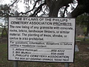
PHILLIPS CEMETERY
Over 1550 graves
In 1880, John W and Nancy Phillips deeded 1.3 acres to the Methodist Episcopal Church South who built what became known as Walnut Springs Church. The weather was so bad on March 13, 1880, that the minister cancelled the morning service. But the elements still had to be braved as 32-year-old Bascombe Sorrell had just died. Buried beside the church, he was the first person to be buried in what became the main cemetery in the Dripping Springs area.
For 60 years, the cemetery was maintained by the Methodists, yet was open to all At first, burials were free of charge. Grave sites were allotted only when the need arose. Local landowners donated more land as needed.
In 1940, the Methodists turned the cemetery over to the community. In 1962, a cemetery association was formed, restricting who may be buried here. It was decided to name the cemetery after the original donors, John and Nancy Phillips, although they are not buried here. They lie in Austin’s Oakwood Cemetery.
In 1991, the Phillips Cemetery was presented with a Texas Historical Marker by members of the Hays County Historical Commission. Twenty years later, Daniel Fairly’s headstone was stolen and later discovered many miles away. Jim Cullen, the historical commission’s cemetery chair at the time, was notified. Recognizing where it belonged, Jim was able to return it.
In 2010, a columbarium was added to the cemetery. There are no restrictions on cremains in the columbarium.
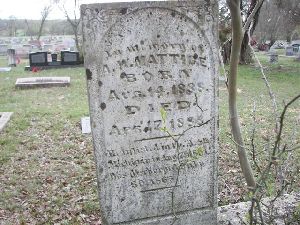
One small gravestone bears witness to the fury of Texas weather. It commemorates five members of the Taylor family who built their home beside the forks of Onion Creek. On the night of September 6, 1882, they were washed away in a deluge, leaving only two of the boys clinging to the branches of a tree.
Information on the cemetery and its current by-laws can be found at www.phillipscemetery.com.
To reach the cemetery from Dripping Springs, take R.R. 12 south (toward Wimberley) at the traffic light. Go 1.9 miles to the junction of R.R. 12 and PM Rd 150. The cemetery is located on the right side of the road, immediately before the junction of the two roads.
PITTS CEMETERY
49 Inscriptions
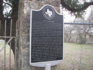
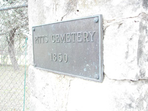
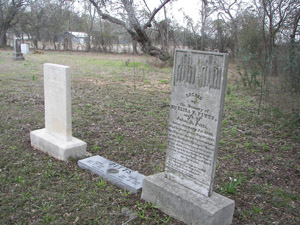
The Pitts Cemetery was established in 1850, according to the sign over the entrance gate. It is located in what was known as Stringtown, just outside of the City of San Marcos. The Texas Almanac does states that the town of Stringtown no longer exists. Stringtown was located on land that was once owned by General John D. Pitts, and covers approximately one acre of land. It is unusual in the way it is laid out.
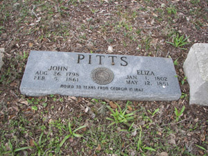
General John D. Pitts settled in the Stringtown area before 1851. His brother, Edward H. Pitts (1813-1854) was one of the earliest burials in the cemetery. Prior to the Civil War, Edward Pitts’ remains were removed from the Pitts Cemetery and interred in Monument Hill Cemetery at LaGrange, Texas. He was buried with other prisoners who had survived the Mier Expedition of 1842. John Malone, two-month-old son of James and Eliza Malone, is the earliest marked grave in the cemetery. He died in 1850.
Narratives from oral history interviews have suggested that this cemetery may be the oldest established cemetery in the county. Pennington Funeral Home may have access to the cemetery, but permission to explore and visit the cemetery must be obtained before entering, as this is a private burial ground. The cemetery is still used by descendants of the early settlers of Stringtown.
To reach the cemetery from Hays County Courthouse in San Marcos, go west on Hopkins Street all the way out of town onto Hunter Road (PM Rd 2439). Hopkins Street becomes PM 2439 at the edge of town. Approximately two miles from the courthouse is the junction of PM Rd 3407 and 2439, at a traffic light. Go straight on 2439 for 2.6 miles. The Pitts Cemetery is located on the left side of the road. This is 4.6 miles from the courthouse. The cemetery has a wrought iron gate, which is kept locked, between two large rock posts. Researching about this cemetery? Contact Hays County Historical Commission Cemetery Chair, Sally Ramirez at farrah1954@gmail.com for more information. For burials contact Helen Munk, Cell: 512-665-4952, Home: 512-357-6617.
PLEASANT VALLEY CEMETERY
(Also known as Peal Cemetery and Valley Ford Cemetery)28 Inscriptions
This cemetery, located approximately eight miles out of Wimberley on the Fischer Road, was once a five-acre tract of land. It is marked on the Texas Highway Department's map as Valley Ford Cemetery; yet it is also known as the Peal Cemetery, named for the man who gave the land for it.
According to Mrs. Ella Schapiro, a resident of the area, Brother J.B. Peal- a Baptist minister donated five acres of land for a church, school, and cemetery. The church and school are no longer in existence. Mrs. Schapiro attended school at the Pleasant Valley School. Adjoining landowners has engulfed much of the original five acres. Approximately one and one-half acres are all that remains fenced for a cemetery, and that fence was put up recently by Mr. Emmitt Burchett of Johnson City, Texas (1989). Mr. Burchett has taken an interest in preserving the cemetery. Prior to his taking an interest in saving the cemetery, the fence had been taken down by nearby landowners, and the cemetery was being desecrated.
According to Mrs. Schapiro there are at least fifty graves in the cemetery, many unmarked. One that she knew was unmarked is that of Elbertine Schapiro Posey. At one time descendants of persons interred in the cemetery paid money on occasions to help pay for upkeep. Through the years the cemetery has been maintained by Martin Schubert (grandfather of Mr. Shapiro), August Schubert, Ed Peal, Elbertine Schapiro Posey, and other members of these families.
To reach the cemetery from the Square in downtown 'Wimberley, take R.R. 12 north. Go .4 mile to the junction of FM Rd 2325, and turn left onto 2325. Go 3.6 miles to Fischer Store Road (Hays Co. Rd 181). Turn left on 181 and go 3.3 miles to the Blanco River Crossing (Old Haster Dam Crossing), and cross the bridge. The cemetery is located approximately .1 mile farther on the left side of the road. It is fenced and there is a large metal gate adjacent to the road. There is no name on the gate and stones are not visible from the road. Look carefully or you will miss it.
PURSLEY CEMETERY
91 Inscriptions
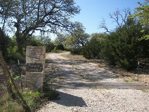
William Darrell Pursley (1820-1892) established this lovely, serene burial spot atop a hill on his ranch when his son, Johnathon, was tragically killed from being dragged by a horse. His burial in November of 1876 was the first in the cemetery.
When W.D. Pursley died in 1892, his son, Will, one of the heirs, sold his part of the ranch, within which the cemetery was contained, to H.F. Hohmann and his wife. Later Mr. & Mrs. Hohmann deeded back to Will Pursley the land on which the cemetery was located: "2 acres more of less." It is presently part of his estate (Hays County Deed Records, Vol. 86, pp 435-436). The land is set aside for cemetery purposes only.
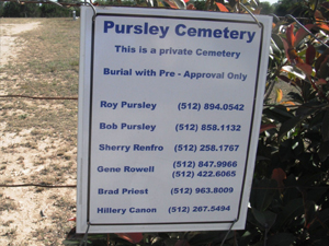
Many residents of the Mt. Gaynor community have contributed through the years toward fences, gates, and general upkeep before the Pursley Cemetery Association was organized in 1983. The first board of officers for the association were: President, Robert Earl Pursley; Vice-President, Roy D. Pursley; Secretary-Treasurer, Ima NeIl Hill. Other board members are Hill Quick and Reagan Greathouse. Robert Earl Pursley is presently (1988) the president of the association and we are grateful to him for the information provided for this history. The cemetery is fenced and well cared for. Burial is limited to residents of Mt. Gaynor and their families. Persons requesting interment privileges for a loved one are requested to contact an officer of the association.
To reach the cemetery from Dripping Springs, at the intersection of U.S. 290 and R.R. 12, go west toward Henly for .3 mile to intersection of Hays Co. Rd 190, and U.S. 290 (across from the Church of Christ). Turn left onto 190, and go 2.3 miles to the intersection of County Rd 220 and 190, where the road forms a "Y". Take a left at the "Y" onto 220 and stay on this road for 5.8 miles. The cemetery is located on the right side of the road. There is a gate, with the name of the cemetery on it, adjacent to the roadway. You will have to enter this gate and drive up a hill for approximately .2 mile. When we visited the cemetery, the road leading up to it was badly in need of work. You may wish to walk, or drive a pickup truck or four-wheel drive automobile. This road is probably graded periodically but after a rain it can be rough.
Click here for information on deceased buried at Pursley Cemetery (PDF).
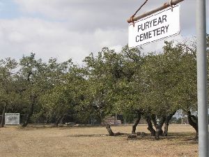
PURYEAR CEMETERY
37 Inscriptions
The Puryear Cemetery was created when Mr. Walter Puryear gave two acres of land to be used as a cemetery. This was after several people had been buried on his land, and he felt the need for a community cemetery. There is a cemetery association with trustees to oversee the care of the cemetery and to arrange for burials. The cemetery is open for burials for the people of the community and descendants of the original settlers of the area.
Originally, the cemetery association fenced only one acre of the two acres set aside; however, when the land surrounding it was sold, the association decided to go ahead and fence the second acre. That explains why there are two chain link fences, making it appear that the cemetery is divided into two sections.
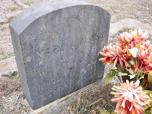
The oldest death date on a stone in the cemetery is that of Mary Glass (1878-1880); however, there are graves older than that one. According to Mrs. Thomas Puryear, a Mrs. Lauderdale was the first person buried in the cemetery. There is a stone marking her grave but it has no dates. Also, Mr. Walter Puryear’s parents are buried here. The cemetery association has marked all graves in the cemetery, even those for which they did not have dates of birth or death. The cemetery is extremely clean and has some of the prettiest oak trees in this area of the county on its grounds.
To reach the Puryear Cemetery from Dripping Springs take R.R. 12 north at the intersection of U.S. Hwy 290. Turn Left on Hamilton Pool Road, then left onto Bell Springs Road. Go exactly two miles. The cemetery will be on the right side of the road approximately 50 to 75 yards off the road.
REAVES CEMETERY
1 Inscription
The Reaves Cemetery, sometimes spelled Reeves Cemetery because stones in the cemetery are spelled both ways, is a small private family cemetery. It is located off FM Road 150, between Dripping Springs and Driftwood. The cemetery is surrounded by property owned by Mr. Scott Marshall of Driftwood.
In her book, Driftwood Heritage, published in 1976, Mrs. Minnie Lea Rogers listed the stones from this cemetery. Since that time one of the stones has disappeared, or Mrs. Rogers listed it because she knew the lady was buried in the cemetery. It is the stone of Caroline A. Gill.
Caroline (Connelly) Gill was born in 1847 in Liberia, where her father, Presbyterian Rev. James McCullough Connelly (1811-1895), had gone as a missionary in 1841. A few months after he arrived, he married the widowed missionary, Catherine (Hammond) Sawyer. They had several children, two of whom died and were buried at Settra Kroo. When Caroline was about two, the family came back to America because of her father’s recurrent bouts of “African fever.” She married Trezevant D. Gill. She died the day after her six-day-old infant.
Dr. Johnnie L. Reeves, of Austin, Texas, has done extensive research on the deceased Reeves family members buried in this cemetery, and it is hoped that he will share the research with the Hays County Historical Commission.
There are ten stones marking eleven graves. One stone marks the grave of a mother and her child. Even though there is a variation of the spelling of the name Reeves/Reaves, the deceased are all of the same family.
From research we found that Mr. William F. Reaves was a leader in the community. He was a trustee of the first school (a subscription school), and later president of the school board. The school was known as the "Reaves School" and the building was also used as a church. This small cemetery is located near his old homestead.
To locate the cemetery from Dripping Springs, go south on R.R. 12, for 1.8 mile to the junction of PM Rd 150, and R.R 12. Turn left onto 150, toward Driftwood, and go 4.7 miles. Turn right onto a graveled lane. (Mailbox address will be Box 9B and 8G) (1988). Drive .4 mile up the gravel lane to the home at dead end of lane. There will be a fence directly in front of you when you reach the end of the lane. Out in the pasture directly in front of you approximately 50 yards will be the cemetery under a mott of trees and grapevines.
We are grateful to Constable Billy Reeves for showing us this cemetery and helping copy the inscriptions.
2009 Update--HCHC Cemetery Committee members Bob Flocke, Dorothy Gumbert, Linda Coker, and Jim Cullen visited Reaves Cemetery in March of 2009 and found the site exactly as described 15 years ago. Scott Marshall, a friendly host, continues to be the land owner of the property surrounding the cemetery and the provider of the chain link fence that protects the old site from livestock. The group was pleased to note the tombstone of Caroline A. Gill is still to be found in the cemetery.
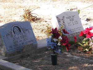
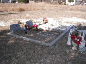
RIZO CEMETERY
2 Inscriptions
Established in 1976, the Rizo Cemetery is a private cemetery located just out of Kyle, adjoining the St. Vicente Cemetery. The Rizo family members live in the mobile homes on the property on which this family cemetery rests. There are presently two graves in this cemetery. They are enclosed in a fence with concrete curbing.
To locate the Rizo Cemetery, take Stagecoach Road (Rd 136) out of Kyle. Go south toward San Marcos for .3 mile from the intersection of Rd 136 and Rd 225. There is a large cemetery adjoining this family burial site. You cannot see the graves from the road as they are approximately 50 yards from the road behind some mobile homes (1988). You can, however, see the graves when you are in the St. Vicente Cemetery – about half way into the cemetery across the fence on the right side.
ROUNDTREE GRAVE
In early 1994, we contacted Ms. Lorraine Joy of Dripping Springs who told us of the burial site of a Roundtree family child. Ms. Joy's mother was Mozelle Sorrell, and her ancestor W. L. Sorrell settled the Millseat area of northwest Hays County and owned the land on which the child was buried.
Between the years 1857 and 1861, Thomas P. Roundtree lived in the Millseat area. It was during this time that one of his children died and was buried.
We visited the area and any additional information found will be filed in our cemetery records of the county archives.
To reach the gravesite from Henly Fire Station drive north on U.S. Hwy 290 for 1.9 miles to junction of Hays Co. Rd.188. Turn left on 188 and drive 1 mi. Cross cattle guard and take left turn at Y immediately after crossing cattle guard. Road Y's again immediately. Take left and drive for .7 mile. You will see an old homestead on the left and several farm buildings on the right, including an old rock cistern and well. Beyond that is a large barn. According to Ms. Lorraine Joy of Henly, behind the barn is the unmarked site of the Roundtree baby's grave. Her mother, Mozelle Sorrell Joy, gave this information to her.
If you do not already have Adobe Acrobat Reader, you may obtain it by clicking here.

