Cemeteries & Locations - S – Z
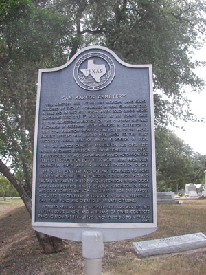
SAN MARCOS-BLANCO CEMETERY
280 Inscriptions
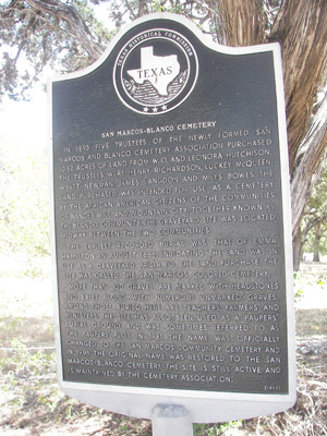
Mr. Wyatt Newman, Mr. James Landon, Mr. Henry Richardson, Mr. Lucky McQueen, and Mr. Miles Bowes established the San Marcos Community Cemetery in 1893. The land was paid for in cash ($200) and the deed signed on June 16, 1893. It was not given the name San Marcos Community Cemetery until 1981. Until that time it was simply referred to as the "Black's Cemetery" by the Anglos, and "Our Cemetery" by the Afro-American citizens. Officially, it was the San Marcos-Blanco Association Cemetery, created in 1901, by a deed recorded in Vol. 42, pages 151-153 Hays County Deed Records.
In October of 1981, several persons met and organized a cemetery association for this cemetery. They decided to give the cemetery an official name that would be known to all citizens of this area. It was named the San Marcos Community Cemetery and was opened to anyone wanting to be buried there. The organization raised enough money to erect a chain link fence around it. Originally, there were 10.62 acres of land; however, it is not known if this is the exact amount of land fenced.
The cemetery is filled with beautiful oak and cedar trees. It is mowed on a regular basis and credit goes to Mrs. Katherine Hardeman and Mr. Charlie Williams for caring for the cemetery.
This cemetery is plagued with vandalism and it is a shame that anyone would desecrate the burial site of anyone's loved ones.
Because of the size of this cemetery we divided it into sections and you will need to refer to our map to find any given section. The section number or letter is found following the death date of the deceased's listing.
The cemetery is located on Post Road (Old Austin Highway) north of San Marcos. Driving from downtown San Marcos, go to the entrance of Aquarena Springs. Turn left just before you cross the railroad tracks. * This will be Post Road. Drive 2.7 miles north toward Five Mile Dam. The cemetery will be on the right side of the road. It is adjacent to the roadway and cannot be missed.
*Since we published our first edition the State Highway Department has changed the route of Post Road. You will need to cross the railroad tracks and then turn left. This may change the mileage from 2.7 to approximately 3 miles.
The historical commission's Cemetery Committee has worked diligently with local resources and scholars in thoroughly researching the personal biographies of the people buried on the cemetery grounds. Every effort has been made to provide the most accurate and complete histories and stories of its residents, please notify us if one finds any errors or omissions in the descriptions to maintain accurate records. Email: Sally Ramirez
SAN MARCOS CEMETERY
SAN PEDRO CEMETERY
720 Inscriptions
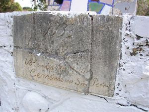
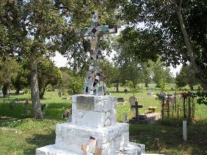
San Pedro Cemetery was established in the early part of this century when the need arose for a cemetery which could easily be accessible to the people and which would better serve the Hispanic citizens of the Centerpoint area. Mr. Ismael Rosales told us his father, Luis Rosales (1882-1955), helped to collect money from the area residents to purchase the property for the cemetery. Both Luis and his wife, Ester, are buried in the cemetery. The cemetery covers approximately three acres of land. Volunteers clean it on a regular basis. There is a cemetery association.
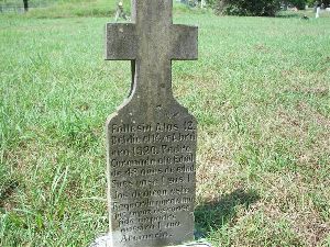
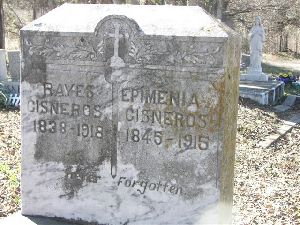
The cemetery has many old stones in it, and most all stones are written in Spanish. Many of the older stones are crumbling as they seem to have been made of concrete and they have not withstood the weather for much more than 25 to 30 years. The earliest date we found on a stone was 1910- on the grave of Narcisco Barrera, who died at the age of 79 years.
This cemetery is referred to as the "Cry Baby Cemetery" by almost everyone in this area of the county. Very few people we spoke to at first knew the real name of the cemetery. There seems to be some sort of superstition associated with the cemetery, but we did not investigate that aspect of its history.
We found one stone for a gentleman who lived to be over one hundred years of age -Porfirio Vargas (6-27-1880/12-27-1980).
We are thankful to Mr. Isrnael Rosales for information regarding this cemetery and to Cassia Hodge, Jean Shand, and Frances Stovall for helping copy the inscriptions.
SAN VICENTE CEMETERY
227 Inscriptions
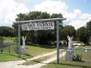
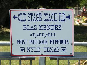
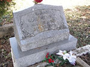
San Vicente Cemetery was named for Vicente Gonzales, who donated the land for a Hispanic cemetery. There was, at that time, no proper burial ground for the Hispanics of the Kyle area. Most Hispanics were buried on property owned by the ranchers for whom they worked. There were many such burial plots scattered allover Hays county. Until Mr. Gonzales donated the land for a cemetery, there was no central place for these citizens of the Kyle area to place their loved ones to rest. Mr. BIas Mendez was a good friend of Mr. Vicente Gonzales, and it was at his initiative that the cemetery was founded and at his urging that the cemetery be given the name to honor Mr. Gonzales for having donated the land.
There are many unmarked graves in the cemetery, and many are marked with some type of cross that does not have any identification on them. When we first began to survey this particular cemetery, it was so overgrown with vines and briars that we could only read a small portion of it. The citizens and family members of loved ones buried there cleaned it to enable us to read all the inscriptions. The back portion of the cemetery has many old graves, most of which are not identified.
To reach the cemetery from downtown Kyle, go west on Center Street for approximately one mile, past the Wimberley road turn-off and past Kyle Middle School, to the intersection of Hays County Roads 136, 225, and Center Street. Turn south (left) onto 136 (also known as Old Stagecoach Road). Go .3 mile. The cemetery will be on the right side of the road. It is fenced and has a double entrance gate with its name above the gate. You cannot miss it.
We are thankful to Cassia Hodge for helping copy inscriptions from this cemetery.
The Hays County Historical Commission along with assistance from family members of those interred at San Vicente Cemetery recorded the tombstone inscriptions up to late 2021. Every effort was made to record the inscriptions accurately, please notify us if you find any errors or omissions in the spreadsheet so that we may maintain an accurate listing. Email: Sally Ramirez
SCHOOL CEMETERY
1 Inscription
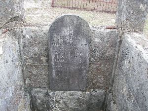
Located on the Blakely Ranch just out of Dripping Springs, in the northwestern part of Hays County, this little private cemetery holds the remains of John T. School, and probably other members of the School family. There are only two graves visible and only one has a stone that is readable. There is a grave, which was enclosed with a rock wall; however, the rock wall has crumbled. The entire burial ground is in sad condition.
There is one grave marked with a funeral home marker from R.B. Underhill of Austin, Texas, but the name of the deceased cannot be read. The one legible marked grave has a tall white marble stone. The cemetery is located across McGregor Lane from the old rock house on the Blakely Ranch, which is located five miles west of Dripping Springs. Since this is on private property, you must get permission before entering.
We are thankful to Maxine and Lynn Storm for copying the inscription from this cemetery.
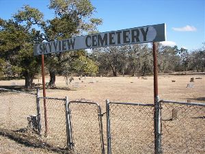
SKYVIEW CEMETERY
173 Inscriptions
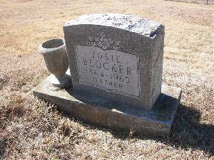
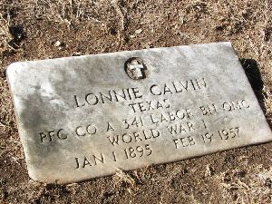
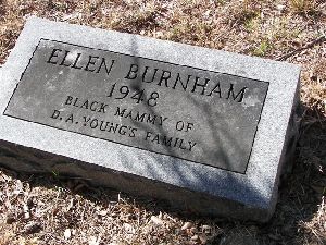
Skyview Cemetery, located in the Kyle area of Hays County, is a rather large and well-kept cemetery covering approximately four acres of land. It has some very old stones marking the burial of some of the area's older Afro-American citizens. There are many graves that do not have headstones. Many graves are marked with large limestone rocks or bricks, which do not have any inscriptions on them. There are several sunken areas indicating a burial, and these also do not have any kind of identification as to who is buried there or when the burial took place. There are over 170 marked graves with stones, funeral home markers, or wooden crosses.
The oldest marked grave is that of Mary Kirby, in 1895; followed by Hattie Washington and Annie Hamilton in 1899. There were probably some burials between these dates, but the graves are not marked.
To locate the cemetery from downtown Kyle, go west on Center Street past the school. At the junctions of Hays County roads 136, 225, and 135, turn left onto 136 {Old Stagecoach Road). Drive south toward San Marcos for approximately two miles. Skyview Cemetery is located on the left side of the road, approximately .2 mile before you reach the Kyle Community Cemetery, also on the left side of the road.
We are grateful to Barbara Barton Younts for helping copy this cemetery.
SLAVE CEMETERY
see Kyle Family Pioneer Cemetery
SPROUSE CEMETERY
3 Inscriptions
The Sprouse Cemetery is a small private family cemetery located in the northwestern part of Hays County between Dripping Springs and Henly, on the Stephenson Ranch. There are five graves in the cemetery; however, only three stones are legible. The other two are so badly decomposed that their inscriptions are illegible. There may be other graves, possibly to the front and to the right of the ones whose location is evident.
The Sprouse Cemetery is on private property and permission must be obtained before entering the ranch. If you are a descendant of this family, we feel sure the landowners will be happy to show you the cemetery.
To locate the Stephenson Ranch, take U.S. Hwy 290 west from Dripping Springs and go approximately five miles to the junction of Hays County Road 187. Turn right (north) onto 187, and go 1.7 miles to the junction of H.C. Rd 188. Turn left onto 188, and go .3 mile. There will be a gate and ranch house on the left side of the road. This is approximately .1 mile past the Moore -Belvin Cemetery on the right side of that same road. Sprouse Cemetery is located in a pasture behind the house, approximately one-half mile from the house. You will need to have someone accompany you to the exact location.
We are thankful to Maxine and Lynn Storm for copying this cemetery.
ST. MARY'S CEMETERY
52 Inscriptions
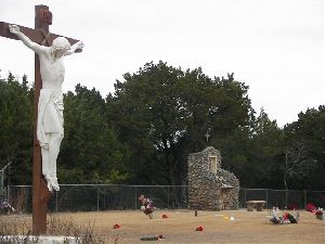
Located .8 mile from the Square in downtown Wimberley, behind St. Mary's Catholic Church on R.R. 12 North, this cemetery was dedicated in 1956. St. Mary's Catholic Church was organized in 1955, when three acres of land were donated by Mr. Ed James, developer of Eagle Rock Ranch, and three more acres were purchased.
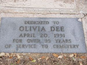
The cemetery is a perpetual care cemetery. Mrs. Ren Dee was appointed the cemetery's first director and has served until the present (1988) time in that position. The cemetery reveals the excellent planning and care that Mrs. Dee has given to her position. The cemetery is divided into six sections; however, burials have only taken place in Section A. Other sections will be opened for burial as needed. There have only been 56 burials in the last 34 years, but as Wimberley grows, so will this lovely cemetery.
ST. MICHAEL'S CEMETERY
263 Inscriptions
Most often referred to as "San Miguel Cemetery" because of the predominance of Hispanics buried in the cemetery, St. Michael's Cemetery is a Catholic cemetery and is located next to the St. Michael's Catholic Church in Uhland. It adjoins the Live Oak Cemetery with only a fence line separating the two cemeteries. The cemeteries were both established at approximately the same time and were separate because of religious beliefs. There are approximately a half dozen Anglo¡s graves in the original section of the cemetery. Almost all other inscriptions are of Hispanics, and most of the inscriptions are in Spanish. The cemetery has become known as the "Hispanic Cemetery"; however, it is definitely a part of the Catholic Church property, making it a "Catholic," not a "Hispanic" cemetery.
The earliest dated stone is that of two children by the name of Wisian, both dying in 1887, and having a double stone to mark their graves. There are many markers shaped as a cross, which do not have any inscriptions on them. Many graves are marked only with a funeral home marker, which will, in time, deteriorated to the point that it will be illegible. Many already have.
The cemetery is located on Old Spanish Trail next to St. Michael's Catholic Church. You cannot fail to see it.
We are grateful to Cassia Hodge for helping copy inscriptions from this cemetery.
ST. STEPHEN'S CEMETERY
27 Inscriptions
St. Stephen's Cemetery is the newest cemetery in the Wimberley area at this time (1988). It was created in 1976, and is part of the Episcopal Diocese of Texas. The five acres, which make up this cemetery, plus twelve acres for the church adjoining it, were donated to the Diocese by the Lyon Brinsmade family.
The cemetery is in the churchyard, and is well kept in natural order. There is a columbarium, or sepulchral vault to contain ashes of deceased.
The present trustees are John Skinner, Faye Albertson, and James W. Greer. They function at the discretion of the Vestry.
WALLACE FAMILY CEMETERY
3 Inscriptions
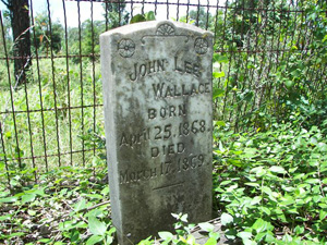
The story has been handed down through the years that the Wallace Family Cemetery plot came to be when a member of the Wallace family died, and the body could not be transported to the top of Wallace Mountain. It is said that a terrible rainstorm had caused the creek to rise between the place of dwelling and the top of Wallace Mountain. It was decided that the body would be laid to rest on the opposite side of the creek. From the dates on the stones, it must have been in 1869, when John Lee Wallace Jr. died aged 11 months.
John’s sister, Mattie Seal, is buried here, but her husband, Charles, rests with his second wife in the Wallace Mountain Cemetery further up the hill. Their father, John Lee Wallace, was a distant cousin of Robert E. Lee, not his nephew as local lore would have it. He served in Captain Carrington’s Company, Gidding’s Regiment, in Colonel J. S. “RIP” Ford’s 2nd Texas Cavalry.
After her husband died, Malvina Wallace went to live with her daughter, Carrie Voight, and is buried in the Voight plot in San Marcos Cemetery.
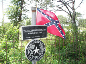
In 2001, the Wallace Family Cemetery was designated a Historic Texas Cemetery.
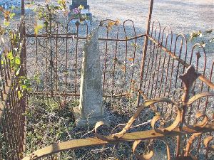
The Wallace Family Cemetery is located .3 mile east from the traffic light at the junction of R.R. 12 an u.s. 290 (going toward Austin from Dripping Springs). It is within ten to fifteen feet of the fence that runs adjacent to Hwy 290 in a small fenced area (approximately 8' x 12'). The plot is fenced with a decorative twisted-wire fence; however, it is so overgrown with vines in the spring and summer that you cannot see the fence or the stones. It is more visible in winter months after a hard freeze. You will need to look very carefully to find it.
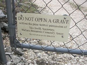
These graves are located on private property and you will need to seek permission "before crossing the property to get to them. We are grateful to the Shelton family for allowing us to enter their property to get to this burial site.
John Lee Wallace and his wife, Malvina Gillespie, both belonged to prominent families in Kentucky’s horse country near Lexington. Although he was not Robert E. Lee’s nephew, as is often claimed, he was a distant cousin. Other distinguished family connections included descent from Pilgrim Father, Isaac Allerton, and kinship to President Zachary Taylor and President James Madison.
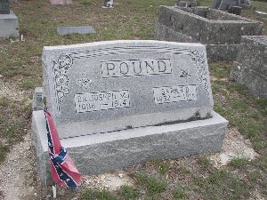
The Wallaces arrived in Texas in the mid-1850s along with several other family members who settled in Travis and Blanco counties. Along with the Pounds and Mosses, they are regarded as the founding families of Dripping Springs. First to put down roots were John L. and Indiana (Ward) Moss, followed by John L. & Malvina (Gillespie) Wallace, and, a few months later, Dr. Joseph M. and Sarah (Ward) Pound who had originally settled about 10 miles further west.
It may well be true that the burial of the Wallaces’ little son, John Lee Wallace Jr, could not take place at the top of what is known as Wallace Mountain because of a rainstorm. But the intended spot would not have been where the Wallace Mountain Cemetery was founded in 1881. At the time, it was on Dr. W.H. Howard’s land, with the boundary line running between the two current cemeteries. Of the Wallace family, only John Lee Wallace; his infant son, John Lee Jr.; and his daughter, Mattie (Wallace) Seal, who died in her early 20s, are buried in the Wallace Family Cemetery. His wife, Malvina (Gillespie) Wallace, rests in their daughter, Carrie (Wallace) Voigt’s family plot in San Marcos Cemetery.
During the Civil War, John Lee Wallace was the postmaster for Dripping Springs, but is not found in official list of U.S. postmasters, having only held the position under the Confederacy. He served in Captain W.H.D. Carrington’s company, Lt. Col. G.H. Giddings’ Regiment, part of Col J. S. “RIP” Ford’s 2nd Texas Cavalry, losing his horse in battle near Brownsville in August 1864.
WALLACE MOUNTAIN CEMETERY
More than 200 graves
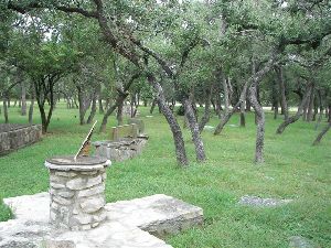
Located atop Wallace Mountain just a short distance east of Dripping Springs, this cemetery has one of the nicest views in this part of the county. Contrary to popular belief, it was never on property owned by the Wallace family. In 1881, two business partners, W.T. Chapman and A.L. Davis, Sr., purchased the land from the heirs of Dr. William H. Howard. Two years later they sold it, “less…one acre (or a sufficiency) of land on top of the mountain known as Wallace mountain, for a Public burial ground for the Neighborhood.”
Many of the first settlers of this area are buried here, including Dr. Joseph Pound and his family. Rev. F.S. Ballard, a noted Methodist minister, is buried in the cemetery, as is notorious outlaw and gambler, B. J. Hines. Henry G. Thurman, who served as a Union soldier in the Civil War, was erroneously given a CSA marker. In 2015, family members ordered a replacement. Henry’s wife, Judia, was first buried in the Thurman Bend Cemetery, but was moved here before the construction of the Mansfield Dam in the 1930s.
The earliest marked grave is that of B.J. Marshall who died in 1872. He was originally buried in the Marshall-Chapman Cemetery in downtown Dripping Springs and was moved in 1936 after the property was sold.
Two other bodies reinterred here are Thomas J. Johnson and his wife Catherine who founded the Johnson Institute where Radha Madhav Dham Hindu Temple now stands. After the headstones were tampered with, the decision was made to move them to Wallace Mountain.
In 2018 the Texas Historical Commission certified Wallace Mountain Cemetery as a Historic Texas Cemetery.
To reach the cemetery, go east on Hwy 290, for .5 mile from the junction of R.R. 12 and Hwy 290 (toward Austin). There will be a graveled entrance into the drive. Turn onto this graveled road, which will wind for .3 mile to the top of the mountain. Keep to the right when the roadway forks. The cemetery is well kept, with a chain link fence surrounding it. We divided the cemetery into sections when we surveyed it, so you will need to refer to the map to find the location of the sections.
The historical commission's Cemetery Committee, utilizing local and scholarly resources, has thoroughly researched the personal biographies of the cemetery's residents. Every effort has been made to provide the most accurate and complete histories and stories of its inhabitants, please notify us if there are any errors or omissions in the descriptions for us to maintain that accuracy. Email: Sally Ramirez
WEAVER CEMETERY
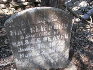
7 Inscriptions
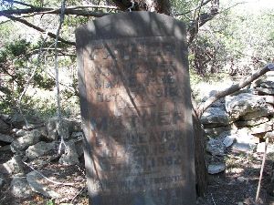
This cemetery is located on the Storm Ranch 6.8 miles south of Dripping Springs off Ranch Road 12. The Weaver family once owned the land it is located on and the area was first known as “Old West Point.” W.M. Weaver set an acre of land aside “for the use of the Weaver family forever.” It is located (1994) a few yards from the Thomas Breedlove home, which was also the Good post office until 1904.
You will need to get permission from Scott Storm before entering the ranch to visit the cemetery. He is very gracious and he will be happy to show the cemetery to family descendants or anyone connected with a historic or preservation organization. Scott’s parents, the late Lynn and Maxine Storm, provided the readings for this cemetery.
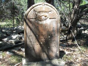
2008 Update – Weaver Cemetery is located in a tiny (est. 20’ X 25’) “notch”tucked into the southern edge of the Storm Ranch. Current ranch owner Scott Storm, who served as guide for the cemetery’s modern-day “scout” of the ranch’s historic cemeteries, indicated he was unclear about the ownership of the site and it appears the small site may be the last present-day evidence of the one acre land-site W.M. Weaver once “set aside.” The Weaver family is well-represented, as is at least one McCall family member. The cemetery is in a small cedar break, protected by an enclosing fence.
WENGER RANCH CEMETERY
1 Inscription
Approximately one-half mile above the Adare Cemetery, located on the Wenger Ranch just out of Wimberley, is the grave of a small child of the Stockman family. The grave is that of an eight-year-old girl who died while her family lived for a short while on the property which later became the Adare Ranch. Tradition has it that the grave was there when Mr. Bill Adare bought the land shortly after the Civil War.
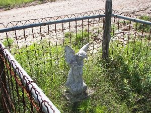
When Mr. and Mrs. P. Cedric Wenger bought the ranch, Mrs. Wenger had an ornamental wrought iron fence made for the single grave to protect it. She placed a cherub statue at the head of the grave. Flowers decorate the grave on certain occasions.
To reach the Wenger ranch, take River Road for 4.2 miles from the Wimberley Square, veer to the right at Wayside Drive, continue up the hill, and follow Wayside Drive until you reach the ranch. Turn left at the ranch entrance and continue up the lane. The grave is located on the left side of the road just a short distance before you reach the Adare Cemetery. The Adare Cemetery is .9 mile from the entrance gate.
Ask permission before entering this private property. The Wenger Ranch foreman's home is on the right as you enter the ranch gate.
WILSON CEMETERY
1 Inscription
In researching the history of Wimberley, we found mention of people being buried in a small private family cemetery where Wilson Creek runs into the Blanco River approximately two miles west of Wimberley. Also mentioned was the fact that almost all the stones have been washed away with floodwaters in the years past. When we visited the site, we found only one grave.
Very few people know that at one time in the mid-to-late 1800'5, this was a much larger burial plot. It is told that W.C. Winters and his wife were both buried there, as well as John Carle "Norway" Wilson (Oleson), his first wife (Liza), and his second wife (Augusta), and at least one of his children (Missouri). The Wilson graves were still present in 1963 (Wimberley's Legacy, pp 36-37), but have since been lost to flood waters.
To reach the Wilson Cemetery, turn at Wimberley Bank (Ozona Branch 1988) onto River Road at the junction of River Road and R.R. 12. Follow River Road for .7 mile; turn right and go .1 mile to a "Y" in the road. The grave is in the yard of a large private home with a peaked roof, straight in front of you. You must ask permission to enter onto property, as this is a private burial site.
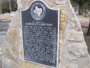
WIMBERLEY CEMETERY
632 Inscriptions
A well-kept cemetery on the Old Kyle Road approximately a mile from the Wimberley Square, covering three and one-third acres, this cemetery was originally part of a 1280 acre tract of land patented to Amasa Turner.
Prior to 1876 most residents of the area buried their loved ones near their homes in small family burial grounds. There are many of these small family plots in the Wimberley area. Melissa Wimberley, five-year-old daughter of Pleasant and Amanda Wimberley, was the first buried in the cemetery in October of 1876. At that time the cemetery was simply part of the church property and land for a cemetery had not been set aside.
In 1885, John Henry Saunders and his wife Callie Williamson Saunders, purchased twenty acres of land from William C. Smith from which they later set aside a one-acre tract for the purpose of a cemetery. This acre of land surrounded the first grave already on the land.
Over the years the cemetery grew and in 1922, when John R. Dobie sold land he had acquired from John Henry Saunders, he set aside "two acres now being used as a cemetery." Then in 1947, for the sum of $5., the widow and heirs of James F. Dobie conveyed a tract of land to the cemetery association's trustees, W.A. Leath, Elton Wagner, and Lloyd Leinneweber. This parcel of land consisted of approximately two-thirds of an acre.
Buried in the cemetery is Hays County's first white settler, William W. Moon (1814-1897). Mr. Moon's wife died prior to his death and was buried in the San Marcos Cemetery. In 1896, Mr. Moon had her remains moved to the Wimberley Cemetery. Mr. Moon was a veteran of the Seminole Indian War in 1838, the Mexican War in 1846, and the Confederate States Army (CSA). He was a Texas Ranger.
Many veterans are buried in the Wimberley Cemetery --too numerous to list; however, we are recording the information in our "Cemetery" files and a copy can be had by writing to the historical Commission of Hays County. On researching in the Tula Townsend Wyatt Collection at the San Marcos Public Library we found that at least 22 CSA veterans rest in this cemetery, and many of their graves are not marked with this information. Also buried in the cemetery is Mr. Pleasant Wimberley (1823-1919), whose tombstone reads '.For Whom The Town Was Named." The stone is a double stone, for he rests beside his wife Amanda (1831-1909). They rest beside their baby daughter Melissa, whose stone reads "First Grave."
The Wimberley Cemetery is one of the larger cemeteries in the county with over 630 inscriptions when read in 1988. There are some unmarked graves. Because of its size, we divided the cemetery into sections and numbered them. You will need to refer to our map to locate the section where a deceased is buried. This number follows the death date after each listing.
The cemetery is located at the junction of Hwy 3237 and Old Kyle Road. We are grateful to C.W. Wimberley for furnishing some of the history of this cemetery.
WINTERS CEMETERY
5 Inscriptions
The Winters Cemetery is so named because there are more stones with the Winters name than with the Daniel name. Also, since reading this little family burial plot, we have come in contact with family descendants that have looked for these graves for over five years and we were told that Alford (Alfred) Winters and Orrin Winters both owned land in this area. Probably Alfred owned the land on which the graves lie as the Daniels buried here are his father-in- law and mother-in-law.
The amazing thing regarding this very small family burial plot (approximately 8' x 15') is its location and the fact that it has survived all these years. Located right in the middle of a new subdivision, a few miles west of Buda, this cemetery has barely escaped the perils of vandalism. Had it not been for Mr. Jim Washburn, who is one of the property owners and on whose property line the cemetery rests, the stones would not be preserved. A rock wall approximately two feet tall encircles the burial plot. It has two large hackberry trees growing out of it. Vandals in the area began to tear down and destroy the site including the stones. Mr. Washburn removed the stones to his garage. When we visited his residence at 313 Towhee, he was very helpful and we unstacked each of the five stones, copied the inscriptions, and returned them for safe keeping.
Since the descendants have been made aware of this burial site, plans are being made to restore the little cemetery and build some type of protective fence to ward off vandals.
To reach the cemetery, located in the Leisurewood Subdivision, take F.M. Rd 967 out of Buda. Go approximately three miles to a Sac-N-Pac grocery store at the intersection of 967 and Canyon Wren Drive. Turn right onto Canyon Wren and drive .4 mile to the second street to your right (Towhee). Turn right onto Towhee and drive to 313 Towhee. The graves are located on the right side of the street, about ten feet from the roadway. It looks very much like a rocked flowerbed.
We are thankful to Constable Billy Reeves for accompanying us to this site and to Cathy Hofner for calling it to our attention. Also, to Mr. Washburn for taking the time and trouble to try to preserve the stones.
YORK CREEK CEMETERY
6 Inscriptions
This cemetery is located on private property and permission to enter must be obtained from Mr. Wilbern or Mr. Heinnemier. Mr. Wilbern accompanied us to the site and helped copy the inscriptions. We are indebted to him. He also related to us that it has not been very long -a few months prior to our visiting - that there were more stones standing than there are now. There is evidence of many burials with no identification left on the graves. Many wooden crosses have rotted away.
We have named this cemetery York Creek because of a lack of name for it, and because we found references to Hispanics being buried at York Creek in the Hays County records. This is the only Hispanic cemetery we found near York Creek, and we believe it to be the one to which reference is made.
This cemetery appears to cover approximately one acre of land. It is not fenced and cattle are allowed to trample in it, accounting for some of the stones having been toppled and covered with debris. We scratched the surface of several places to uncover a stone or two, and if someone were to scrape a layer of topsoil and mulch from this area, we feel sure many more stones would be uncovered. However, the cemetery is no longer being used, and will probably be lost to history in a few short years unless someone takes the initiative to preserve it. It is a Hispanic cemetery in origin and we feel sure that very few people know of its existence.
To reach the cemetery from intersection of IH 35 and Posey Road (Hays Co. Rd 235), located approximately five miles south of San Marcos, take Posey Road and go east for 1.3 miles to the junction of Hays Co. Rd 266 and 235. Turn right onto 266, and go .8 mile to the junction of Rd 265. Turn left on 265, and drive 2.1 miles to the old Wilbern homestead on the left side of the road. Across the road from this home on the right side of 265, is a pasture beyond the plowed field. At the edge of the pasture land, along the creek bed is the cemetery. There is a barbed wire fence running directly through the middle of the cemetery separating the Wilbern and Heinnemier properties.

